Ever thought about how a simple geographical feature influences a whole nation’s culture? The Continental Divide in Canada is more than a physical barrier. It also splits the nation culturally. By exploring its impact, we see how geography, policy, and cultural expression intertwine. This gives us insight into how different areas develop unique identities and values.
Key Takeaways
- The Continental Divide plays a crucial role in the geographical separation of cultural regions in Canada.
- Geographical features influenced by the Continental Divide contribute to language and ethnicity distribution.
- Historical events and policies have interacted with the Continental Divide to mold cultural regions.
- The Canadian Shield and the Rocky Mountains represent geological formations that impact cultural geography Canada.
- The Divide’s influence extends to socio-economic factors, affecting regional identities and societal values.
Understanding the Continental Divide
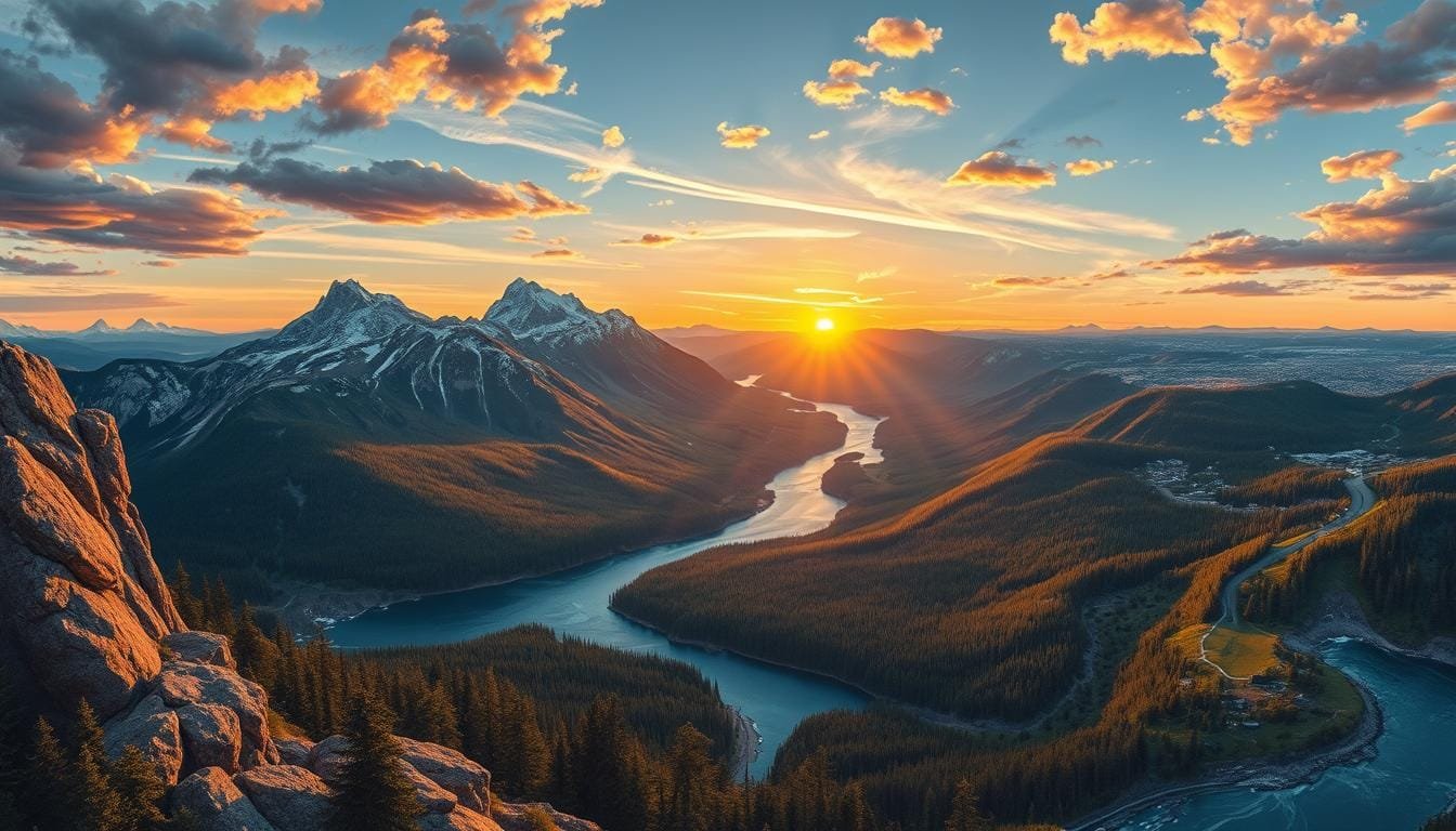
The Continental Divide is a key feature in North America. It runs from the Bering Strait to the Strait of Magellan. It decides where water flows across the continent. Its effects reach into Canada, impacting the country’s geography.
Rivers and drainage systems split based on this boundary. This division shapes ecosystems and where people live.
The Divide does more than direct water; it also affects elevation. For example, Grays Peak is the Divide’s highest point in North America at 4,352 meters (14,278 feet). The lowest point, at the Isthmus of Rivas, stands at just 47 meters (154 feet) above sea level. These differences show how the Continent Divide affects Canada’s geography.
One fascinating detail is how the Divide controls water flow. At Triple Divide Peak, water heads toward three oceans: the Pacific, the Arctic, and the Atlantic. This fact highlights the Divide’s complex nature.
The Continental Divide also changes weather and environments along its path. The Columbia Icefield, for instance, gets about 10 meters (33 feet) of snow every year. Most of that snow turns into glacial ice. This difference affects areas around the Divide, leading to Canada’s varied geography.
In summary, the Continental Divide covers vast areas and different terrains. It plays a big role in defining Canada’s physical features and creates diverse landscapes.
Historical Influence of the Continental Divide on Canadian Regions
The Continental Divide has had a big impact on how Canada grew, especially during the *Colonial Period and Early Settlements*. By looking at these key times, we learn how the Divide shaped the setup of different colonies and Indigenous lands.
In the *Colonial Period*, the Divide was a natural line that set boundaries for colonial rulers. French and British settlers were shaped by the mountains, leading to where they started their colonies. The tough Rocky Mountains made distinct areas for French and British expansion.
The *Colonial Period and Early Settlements* clearly divided Indigenous groups with big mountain ranges. These natural divides were key in setting their lands, trade paths, and ties between tribes. For instance, tribes on the west side of the Divide lived differently from those on the east.
The Divide deeply affected Indigenous cultures in Canada. It didn’t just guide where people moved. It also shaped trade among native groups. This led to a variety of Indigenous cultures, each fitting their specific places.
- The Great Basin covers most of Nevada and big parts of Utah, California, Idaho, Oregon, Wyoming, and Baja California.
- Mount Rushmore is about 68 miles from the Badlands.
- Denali, North America’s tallest mountain, is over 20,000 feet high.
Moreover, the Continental Divide changes how water flows over long distances. For example, Glacier’s Triple Divide Peak, at 8,020 ft (2,446 m), sends water to the Atlantic, Pacific, and Hudson Bay. The water moving Northeast from Waterton to the Saskatchewan River Basin shows how water systems connect because of the Divide.
The Continental Divide’s historical role is important in understanding colonial Canada and its Indigenous people. Knowing about these early effects helps us appreciate Canada’s cultural and historical growth.
| Feature | Detail |
|---|---|
| Triple Divide Peak Height | 8,020 ft (2,446 m) |
| CDT Length | 3,100 miles |
| Flow Directions from Triple Divide Peak | Atlantic Ocean, Pacific Ocean, Hudson Bay |
| Establishment Year of CDT | 1978 |
| Notable Triple Divide Areas | Glacier National Park, Jasper National Park, Siberia |
| Northeast Flow Direction from Waterton | Saskatchewan River Basin toward Hudson Bay |
The Socio-Economic Impact
Understanding the socio-economic factors in Canada’s Continental Divide regions is key. These factors shape economic activities differently on each side of the Divide. They do this through access to natural resources and geographical features.
The Prairie Provinces have lots of farmland. This supports big grain and beef farms, making a strong agri-economy. Alberta is rich in fossil fuels. It’s a hub for extracting coal, oil, and natural gas. It’s even said Alberta’s tar sands have more oil than Saudi Arabia’s reserves.

Continental Divide’s socio-economic impact also changes where people live and settle. For example, over 90 percent of Canadians live close to the US border. This affects trade and culture, mainly due to geography. Ontario, with 39 percent of Canada’s people, uses its location and resources for various economic activities.
British Columbia makes up about 13 percent of the population. Its economy benefits from the Pacific Ocean. It supports fishing, forestry, and tourism. The Divide clearly separates west’s resource-based economies from the east’s farm-based ones.
Professor Walter E. Hecox’s research shows changes in the Rockies. Here, old resource extraction shifts to amenity-based values. Managing resources sustainably and tracking demographic trends are key. They show how geography influences economic development. Understanding the Continental Divide’s role helps locals and policymakers plan for the future.
How Geography Shapes Cultural Identity
The vast geography of Canada, especially the Continental Divide, greatly shapes its culture. This natural barrier not only splits the landscape. It also creates unique ways people live, talk, and celebrate their traditions.

Language and dialects show how geography influences cultural identity. Areas separated by the Divide develop distinct linguistic styles. For example, the way people talk in British Columbia and Alberta is quite different. This shows the impact of their separate environments. These differences do more than change how people speak—they shape a sense of belonging and community.
Geography also affects regional traditions and festivals. Alberta’s Calgary Stampede celebrates cowboy life and farming heritage. On the other side, British Columbia highlights its city culture and diversity at the Vancouver International Film Festival. These events celebrate each area’s unique background, strengthening local identities.
Food and indigenous traditions also reflect geographic adaptation. Growing corn, squash, and beans is crucial in indigenous cultures. These crops influence what people eat and inspire local festivals. Such traditions honor the importance of these crops in their history.
Here is how the Continental Divide influences cultural identity:
| Aspect | East of the Divide | West of the Divide |
|---|---|---|
| Language and Regional Dialects | Maritime English accents | Pacific Northwest dialects |
| Festivals and Traditions | Quebec Winter Carnival | Vancouver Cherry Blossom Festival |
| Indigenous Practices | Harvest Festivals | Traditional Fishing Ceremonies |
| Agricultural Products | Maple Syrup Production | Wine regions in the Okanagan |
The Continental Divide does more than divide Canada—it defines it. It shapes how people talk, celebrate, and go about their daily lives. This blend of geography and culture creates Canada’s rich and complex mosaic.
Does the Continental Divide Divide Canada into Its Cultural Regions?
The Continental Divide plays a key role in shaping Canada’s cultural boundaries. Extending across the North American continent, it acts as a backbone. It influences how regions in Canada develop their own identities.
The physical separation by the Continental Divide creates unique cultural areas. The Rocky Mountains form a natural barrier. They define not only ecological regions but cultural ones too. The formation of the Ancestral Rocky Mountains happened between 320 million and 280 million years ago. This event created the distinct geographical features we see today.

Cultural regions are shaped by historical and socio-economic activities around the Divide. The Continental Divide Trail stretches over 3,000 miles. It’s a path for hikers and a corridor for cultural exchange. The trail links ghost towns to modern communities, showing how history and the present coexist along the Divide.
The Continental Divide also affects indigenous communities in Canada. Many Native American tribes have lived along its path for centuries. They maintain strong connections with the land. This reinforces Canada’s cultural boundaries and creates a patchwork of traditions.
Ecological diversity influences cultural identities too. The Trail crosses five different life zones. Each zone has its own plants and animals. This diversity leads to various cultural practices like ranching, farming, forestry, and tourism. Each is adapted to the local environment.
In conclusion, the Continental Divide’s influence on Canada’s cultural regions is significant. It brings together geological history, cultural heritage, and ecological diversity. While it physically divides the landscape, its impact reaches into the nation’s social and cultural life.
Cross-Border Cultural Influences
The Continental Divide shapes North America’s physical layout. It also boosts cross-border cultural exchanges between Canada and the U.S. This exchange is seen in trade, media, and culture, enriching both nations’ cultural scenes.
In the 1950s and 1960s, TV became powerful. It helped blur the lines between countries, promoting shared cultural experiences. The creation of the Canadian Communication Association in 1980 in Montreal aimed to enhance cross-border communication. The book “Mass Communication in Canada” from 1987 by Rowland Lorimer and Jean McNulty stressed media’s role in this process.
Detroit’s media notably increased Canadian access to U.S. cable TV, showing how close nations can share more culture. Religious interactions also show cross-border influence. For example, Canadian evangelicals form a smaller group than in the U.S. Differences exist, but U.S. culture and media greatly influence Canadian society.
Cross-border cooperation plays a key role in cultural exchange. It involves border security, politics, and education. Such cooperation has boosted Canada’s socio-economic growth, especially near the Ontario-Michigan and Cascadian Border Regions.
In Canada, cultural discussions are more secular than in the U.S. This affects the spread and acceptance of various beliefs. Canadian evangelicals, for instance, are usually less confrontational than their U.S. counterparts, showing cultural differences.
Border regions are crucial for collaboration but face challenges from politics and security measures. Still, the North-South Cultural Exchange keeps enriching societies on both sides of the Continental Divide.
Conclusion
The Continental Divide plays a big role in Canada’s cultural diversity. It has influenced everything from history to how people in Canada connect with each other. This understanding helps us see Canada’s complex cultural makeup more clearly.
The Continental Divide Trail stretches over 3,100 miles, from Canada down to Mexico. It’s more than just a landmark; it represents how geography shapes our cultural identity. The trail goes through a wide range of elevations, offering various experiences. This diversity reflects the cultural variety within Canada.
Since 1977, the CDT has been a place for exploring different landscapes and natural features. It shows how Canadians value community and government support, highlighting our unique culture. Understanding the Divide’s impact lets us appreciate Canada’s cultural unity better. It shows how important geography is in our national identity.
FAQ
What is the Continental Divide?
The Continental Divide, also known as the “Great Divide,” is a natural boundary. It runs through Canada and the United States. It marks where rivers flow to different oceans.
How does the Continental Divide impact Canadian cultural regions?
The Continental Divide shapes Canadian cultural regions. It creates distinct cultural identities. This affects how people talk and celebrate in different areas.
What historical influence did the Continental Divide have on Canada during the colonial period?
During the colonial times, the Continental Divide marked zones for colonial powers. It influenced where settlements were made. It also affected indigenous cultures, like their trade and relations.
Can you explain the socio-economic impact of the Continental Divide on Canadian regions?
The Continental Divide shapes socio-economic factors in Canada. It affects where people live, resource locations, and roads. These differences lead to varied economic growth in different areas.
How does geography shape cultural identity in Canada?
Geography drives Canada’s cultural identity, especially the Continental Divide. It makes regions develop their own ways of speaking and celebrating. These unique traits define each area’s identity.
Does the Continental Divide create cultural boundaries in Canada?
Yes, the Continental Divide creates cultural boundaries in Canada. It separates areas, leading to different cultures. These differences are seen in language, festivals, and traditions.
Are there cross-border cultural influences between Canada and the United States due to the Continental Divide?
Yes, the Continental Divide leads to cultural exchanges between Canada and the U.S. These exchanges mix cultural elements. They affect language, traditions, and more.
Can you summarize the cultural significance of the Continental Divide in Canada?
The Continental Divide is key in Canada’s culture. It creates physical and socio-economic limits, leading to unique cultural areas. These regions have their own languages, traditions, and economies.
